Gawler River flood management
The Gawler River catchment was one of the hardest hit areas in the 2016 flood event.
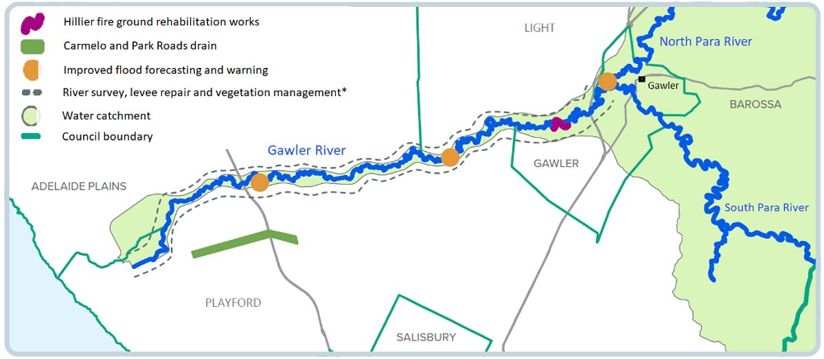
To manage future flood risk, the South Australian Government is investing $9 million between 2020 to 2023 in 4 projects:
- Hillier fire ground rehabilitation works to remove weeds and fallen trees to reduce the likelihood of blockages in the river channel
- Carmelo and Park Roads drain to be built to enable excess water to drain away more quickly
- Improved flood forecasting and warning via new and improved monitoring systems
- River survey, levee repair and vegetation management to improve the river’s capacity to carry water.
This is a collaborative project being delivered with other state government agencies, Adelaide Hills Council, Adelaide Plains Council, Barossa Council, City of Playford, Town of Gawler, Light Regional Council, and the Gawler River Floodplain Management Authority.
See the Gawler River Project Update - December 2023
This map shows the project locations in the Gawler system:

* Project 4 encompasses the entire length of the lower Gawler River as shown above. We will work with landholders to identify the exact location of works.
To find out more about levee banks, see the project page for Levee bank management.


