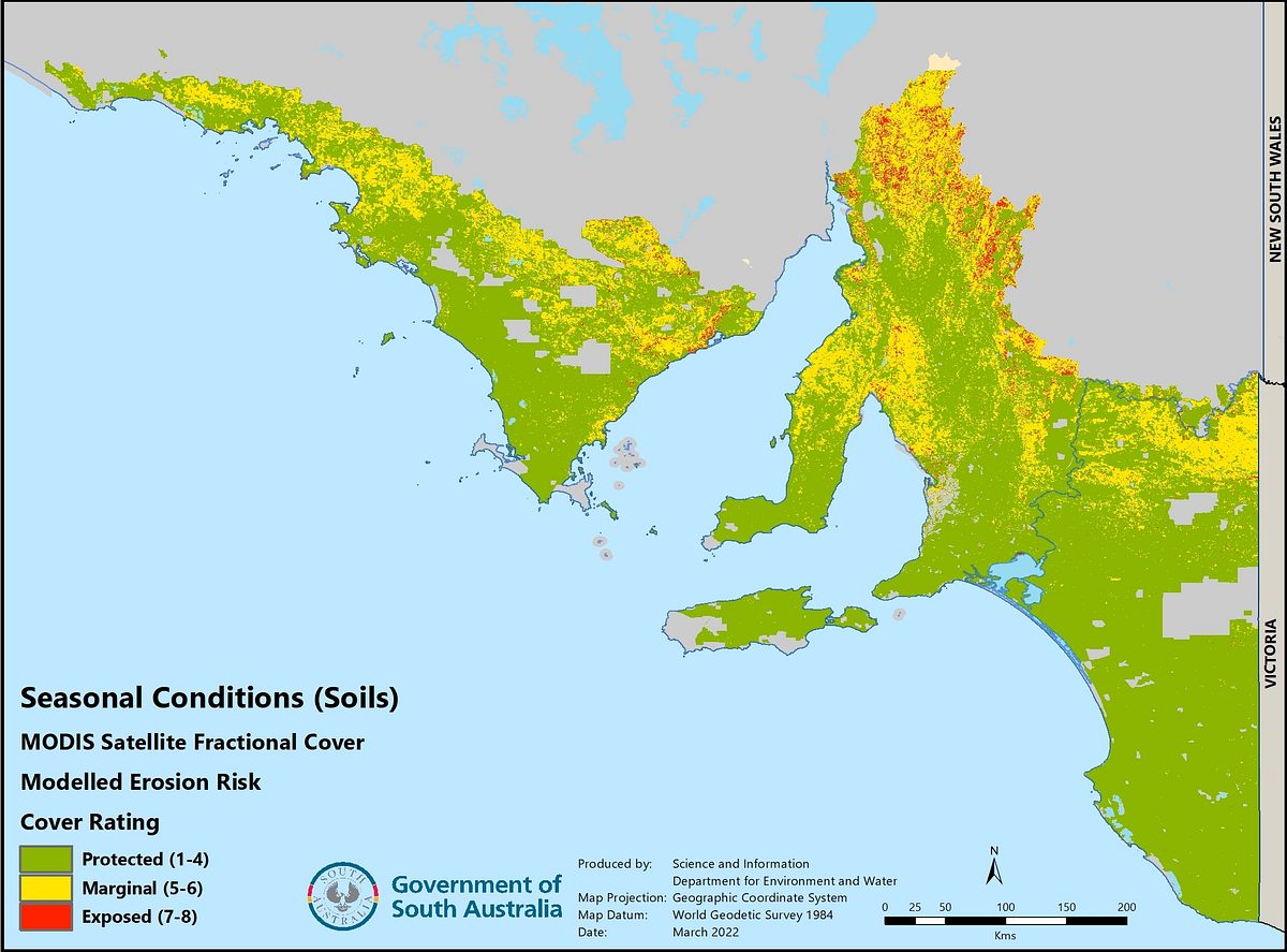
Satellite erosion protection monitoring
Since October 2021, the field surveys have been downscaled as DEW has changed to using a method of monitoring soil erosion risk that uses satellite data. This uses monthly MODIS Fractional Cover satellite data developed by CSIRO which estimates percentage of fractional cover for ‘green’ (photosynthetic) vegetation, ‘dry’ (non-photosynthetic) vegetation and bare soil.
The sum of the green and dry fractions is the estimate of percentage vegetative groundcover which is used as the surrogate for estimating erosion risk. This data is modelled with the ground cover ratings from geolocated sites of previous erosion protection field surveys, to increase its accuracy under local conditions. The MODIS 500 metre pixels are also disaggregated to a 100 metre resolution.
Mapped inherent potential for wind erosion and water erosion across the agricultural zone is also combined with the percentage groundcover data, to estimate actual erosion risk. Modelled erosion risk is produced across the state’s agricultural zone in October, March, May and June each year, corresponding to the field survey months. Using the current October data and groundcover change rates from October to March from previous surveys, erosion risk for March in the following year is also forecast.
While this method does not assess other factors that affect erosion risk such as soil disturbance (looseness), it covers all of the landscape rather than just the transects observed in the field surveys. Smaller scale field surveys are now conducted on an ongoing basis to ground-truth the accuracy of the modelled data.


