Water data, science and monitoring
Water data

WaterConnect
The latest information about South Australia's water resources, providing direct access to water-related publications, technical reports and data sets, including:

Water Data SA
Real-time water data for flow, operations, surface water, groundwater and meteorological monitoring throughout South Australia, including:

The River Murray – System view (Murray-Darling Basin Authority)
Provides a simple overview of water flowing through the River Murray system
Mapping

View potential areas inundated at different flow levels.

River Murray inundation mapping
Predicted inundation mapping for flow events of 60GL/day, 90GL/day, 120 GL/day, 140 GL/day and 160L/day.

A series of maps showing levee profiles along the lower River Murray between Mannum and Wellington.

River Murray infrastructure mapping
View structures on the River Murray floodplain that could now be submerged due to high flows in the river
Reports
Access regional water resources assessments, reports we prepare annually, via the WaterConnect Interactive Map.

Water management in South Australian towns and cities is informed by monitoring data, analysis and research.

Murray-Darling Basin Authority River Murray Weekly Report
Provides updates on operations, river flows, storage inflows, gauge levels, rainfall and salinity data.


Access statewide geoscientific and geospatial data on the South Australian Resources Information Gateway.

Water information on the Bureau of Meteorology
The Bureau of Meteorology is a rich source of water information including the Australian Water Outlook, Australian Water Data Service, and Flood Knowledge Centre.
Water science
Our water science focuses on understanding and managing our ground and surface water resources to support productive communities and healthy ecosystems, while our water monitoring provides the data needed to see trends in water quality and quantity. For example, our work helps find and sustainably develop new sources of underground water to support communities, mining, agriculture and other industries.
Critical to the success of water management in South Australia and the development of new industry opportunities has been the integration of science and research capabilities. This includes:
- modelling capacity and its application to complex water systems
- environmental assessment tools
- data management systems
- metering and measuring.
Water research is essential to gaining an understanding of:
- the state's water needs
- methods of water delivery
- sustainable water resources
- impacts of climate change on water
- effective water management and use.
Watching water
Water monitoring
South Australia has a comprehensive monitoring program that helps manage our water resources and ensures that we have enough water for the future.
The department is the lead agency for water monitoring in South Australia. Our water resources monitoring team collects data from 3,645 groundwater sites and 245 surface water sites across the state. The dataset from this monitoring is augmented significantly by data collected by other organisations and water users.
Water data helps us to understand the quantity, quality, location and condition trends of our water. With this knowledge, the South Australian Government can manage potential impacts on these resources, and ensure there is ready, reliable and sustainable water to support the health of the environment, industry and communities.
Information gathered through water monitoring enables the government to make informed decisions by providing answers to the following questions:
- How much water is there?
- Where is the water?
- What is the quality?
- What are the characteristics of the water resource?
- What trends are evident?
- How much water is being used?
- What is the water being used for?
See South Australia's water monitoring policy, guidelines and procedures.
Monitoring schedules
Our site visits are scheduled on an annual basis to collect and record the state’s water data. Follow @SAEnvirWater on Twitter for monitoring schedule updates or email us at DEW.ResourceMonitoring@sa.gov.au.
During these times you may see staff visiting water monitoring sites. If you do see us in the field, please stop and say hi, we’ll be happy to chat about our monitoring work.
Field staff may also contact you directly regarding accessing your property so we can visit some of our monitoring site locations.

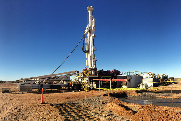
Groundwater monitoring and main valve replacement in artesian wells
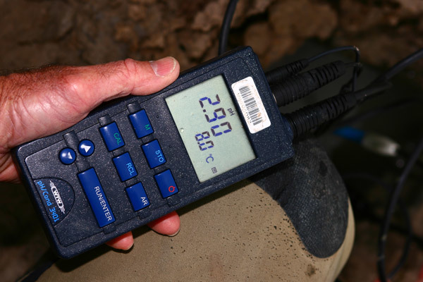
Groundwater monitoring helps us understand the quantity and quality of water beneath the earth’s surface.

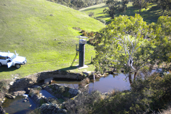
Water in rivers, lakes, wetlands and estuaries is a limited resource in South Australia. Here's how we monitor it.

Weather and climate monitoring
To a large degree, our climate dictates the amount of groundwater and surface water resources in our state.
Image gallery